The highest mountain in British Columbia is Fairweather Mountain (4,663 metres) located at the southern end of the St. Elias Mountains, along the coast of the northern Alaska Panhandle. Fairweather straddles the international boundary between Canada/British Columbia and the United States/Alaska.
Fairweather Mountain. 4,663 metres. 15,388 feet

Author: Sam Beebe – flickr.com
Approach is from the Grand Plateau Glacier.
| Attribute | Details |
|---|---|
| Altitude | 4,663 m, 15,388 ft |
| Location | 58° 54’ 00” N – 137° 31’ 00” W |
| NTS Map | 114 l/13 or I/14 Mount Root |
| Calendar | Best Climbing Months: April, May, June |
| National Park Service | Climb and weather information |
| Parks | Tatshenshini-Alsek Provincial Park |
| Fast Facts | CAPITAL: Victoria, BC PROVINCIAL FLOWER: Pacific Dogwood PROVINCIAL BIRD: Stellar’s Jay TREE: Western Red Cedar |
History
First ascent credited to Allen Carpé and Terris Moore 8 June 1931. Second ascent 26 June 1958, by an all-Canadian climbing party, to mark the centennial of the Crown Colony of British Columbia.
Fairweather Mountain, towering just fourteen miles from the Pacific Ocean, is the dominant peak in the Fairweather Range. The Fairweather Range is located at the southern end of the St. Elias Mountains, along the coast of the northern Alaska Panhandle. Bordered on the west by the spectacular Tatshenshini and Alsek Rivers, and on the north by Glacier Bay, it is quite awesome for its vertical relief and incredible snow pack. The mountains rise almost three vertical miles directly out of the sea, with the 15,300 foot summit of Mount Fairweather only 24 miles from the coast. It is a broad mountain with a sharp icy summit, and contrary to the implications of its name, is subject to some of the world’s worst weather. Its huge Fairweather Glacier flows beautifully from the mountain’s southern flanks to the sea.
Best time to travel
The best time to climb here is May through early July. The weather follows a maritime pattern, resulting in a healthy snow pack and warmer than average winter and early spring temperatures. Summer temps average 42 to 62 degrees, but tends to get stormy, and the wind and snow on the high peaks can be deadly. Its extreme relief and large annual snowfall makes it very glaciated and beautiful. The south face’s 10,000+ ft. relief is bisected by the Carpe’ Ridge which is featured in Steve Roper’s “50 Classic Climbs of North America”.
We will fly into 8,000 ft above sea level on the Grand Plateau Glacier and spend a couple of days acclimatizing before moving up.
As an additional note it must be mentioned that while the majority of the mass of the peak resides within the state of Alaska, the summit itself belongs to British Columbia in Canada. The highest mountain entirely within British Columbia is Mount Waddington (4,016 metres) in the Coast Mountains. It was named in 1918 by the Geographic Board of Canada for Alfred Waddington who, from 1858 to 1872, encouraged the creation of a transcontinental route to the Pacific via Bute Inlet, the head of which is 60 kilometers south of the mountain.
Climbing Preparations and Equipment
When planning an ascent of Fairweather Mountain, climbers must meticulously prepare, ensuring they have the appropriate gear and equipment for a safe and successful climb. This mountain, known for its severe weather conditions and challenging terrain, demands respect and thorough preparation.
Essential Climbing Gear
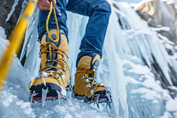
- Mountaineering Boots: A sturdy pair of insulated, waterproof mountaineering boots is crucial. These should be compatible with crampons for ice climbing.
- Crampons: Steel crampons with anti-balling plates are necessary for the icy and snowy surfaces you will encounter.
- Ice Axe: An ice axe suitable for technical mountaineering is vital for both ascent and descent. This tool is essential for balance, climbing steep sections, and self-arresting in case of a slip or fall.
- Climbing Harness: A well-fitting climbing harness equipped with gear loops to hold additional equipment is important.
- Helmet: A climbing helmet is necessary to protect against falling rock and ice, which are common hazards on mountain climbs.
Recommended Clothing
- Insulating Layers: Climbers should wear multiple layers of clothing that can be adjusted as temperatures change. These include a base layer that wicks moisture away from the body, an insulating middle layer, and a waterproof and windproof outer layer.
- Down Jacket: A high-quality down jacket is essential for warmth, especially during rests or in case of unexpected weather changes.
- Gloves: Waterproof gloves with a separate insulating layer are best to keep hands warm and dry.
- Beanie and Balaclava: A warm beanie and a balaclava for face protection against cold winds are important, especially at higher altitudes where temperatures drop significantly.
Safety Gear
- GPS and Maps: Navigation tools such as a GPS device, along with traditional maps and compass, are essential for finding your way, especially in poor visibility conditions.
- First Aid Kit: A well-stocked first aid kit tailored for mountaineering should include items for treating frostbite, cuts, and altitude sickness.
- Communication Device: A satellite phone or a two-way radio can be lifesaving in emergencies, providing a way to call for help if necessary.
- Emergency Shelter: An emergency bivouac sack or a lightweight tent can be crucial if sudden weather changes force an unplanned overnight stay on the mountain.
Conservation and Environmental Impact
Environmental Vulnerabilities of Fairweather Mountain
The juxtaposition of the mountain’s harsh climate and its coastal proximity creates a fragile ecological balance that is sensitive to changes, particularly those brought on by human activities. Such sensitivity underscores the need for responsible visitation practices.
Active Conservation Measures
- Protected Natural Areas: Significant portions of the surrounding terrain, including areas within Tatshenshini-Alsek Provincial Park, are legally protected to prevent undue commercial and industrial impact, thus preserving the landscape and its biological communities.
- Scientific Studies: Regular environmental studies help track the condition of ecosystems, measuring the impact of human presence and guiding the development of policies aimed at minimizing ecological disruption. Visitors can aid these efforts through contributions and volunteer activities.
- Partnerships with Indigenous Populations: Conservation strategies frequently involve working with local indigenous groups, who possess an intrinsic understanding of the ecosystem. These partnerships help to ensure that land management practices incorporate traditional ecological knowledge.
Best Practices for Environmental Preservation
Adhering to the following best practices is crucial for all visitors to help preserve the integrity of Fairweather Mountain:
- Adopt Leave No Trace Ethics: Prepare thoroughly, dispose of all waste correctly, leave natural objects undisturbed, maintain a safe distance from wildlife, show consideration to fellow visitors, and reduce campfire impacts by favoring portable stoves.
- Efficient Waste Management: Carry out all garbage and leftover food. Use environmentally friendly products and ensure all washing occurs well away from any water bodies to avoid contamination.
- Wildlife Respect: Watch wildlife from a distance, do not attempt to interact with them, and absolutely refrain from feeding them. Feeding wildlife can harm their health and disrupt their natural behavior patterns.
Embracing these stewardship principles ensures that Fairweather Mountain remains a spectacular and healthy environment for generations to come. It’s through our collective efforts that we can contribute to the ongoing preservation of this extraordinary natural wonder.
Conclusion
Fairweather Mountain, towering at 4,663 meters, marks the highest point in British Columbia and lies on the international boundary shared with Alaska, named in 1778 during a period of notably clear weather. Essential climbing preparations include acquiring specific gear like insulated boots, technical ice axes, and advanced navigation tools, readying climbers for the mountain’s extreme conditions. Significant conservation initiatives protect the mountain’s diverse ecosystem; visitors must adhere to environmental guidelines like the Leave No Trace principles to help preserve the natural habitat. Fairweather Mountain provides a majestic climbing experience, renowned for its steep ascents and spectacular proximity to the Pacific, making it a pinnacle challenge for climbers across North America.
FAQs
Which specific gear is recommended for tackling Fairweather Mountain?
To successfully ascend Fairweather Mountain, climbers should prepare with thermal boots, specialized ice axes for technical climbs, precise navigation tools, and robust safety equipment designed for extreme mountain conditions.
How are conservation efforts implemented to protect Fairweather Mountain’s ecosystem?
Conservation strategies include strict adherence to Leave No Trace principles to safeguard its rich biodiversity and minimize human impact on the fragile environment.
Why is the climb on Fairweather Mountain considered exceptionally challenging and unique?
The climb offers unique challenges due to its towering altitude, proximity to the Pacific, and the sheer, icy slopes that provide dramatic views and demanding physical challenges, attracting elite mountaineers globally.