The name “Ishpatina” comes from an Ojibwe language word ishpadinaa, meaning “high place”. Spadina Avenue in Toronto is derived from the same word. Ishpatina Peak is the highest point of Ishpatina Ridge. It is the highest point in Ontario. Between 1966 and 1972, Ogidaki Mountain was thought to be the high point, but was found to be 28 m lower than Ishpatina. Before 1966, Tip Top Mountain at 640 m was considered the highest.
The Peak has an 80-foot fire tower. Canoe-accessible hiking trail. Ontario Base map gives heights of two parts of the ridge as South 690+ m and North 677 m
Ishpatina Range. 692 metres. 2,274 feet
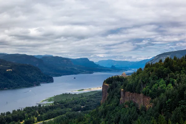
View of Scarecrow Lake from Ishpatina summit.
| Attribute | Details |
|---|---|
| Altitude | 692 m, 2,274 ft |
| Location | 47° 19′ 00” N – 80° 44′ 00” W |
| NTS Map | 041 P07 Smoothwater Lake |
| Calendar | May – June or September |
| Parks | Lady Evelyn-Smoothwater Provincial Park |
| Fast Facts | CAPITAL: Toronto, Ontario PROVINCIAL FLOWER: White Trillium PROVINCIAL BIRD: Common Loon PROVINCIAL TREE: Eastern White Pine |
| Web Links | www.myccr.com bivouac.com |
History
Ishpatina is an Ojibwa term which means “high hill”. The highest spot in Ontario, 95 kilometres north of Sudbury, was determined only in 1972 when Ishpatina Ridge, with an elevation of 693 metres, was found to be 28 metres higher than Ogidaki Mountain. The latter, near Sault Ste. Marie, was declared in 1966 to be the highest elevation. Before that, Tip Top Mountain near Lake Superior, at 640 metres, was considered the highest.
The highest point in the Ishpatina Range is located 400 feet within the Sudbury District. On the topographical maps and in discussion with the Parks Superintendent, there are two points which seem to be within feet of one another.
Routes
Located about halfway between Sudbury and Kirkland Lake, the mountain is not very accessible; the closest highway is more than 50 km away and roads and trails are scarce in the remote area and difficult to travel in poor weather.
Ishpatina Ridge, situated in the heart of Northern Ontario`s Temagami wilderness, is the highest point in the province. It can be a round-trip destination, or the mid-point of a north-south trip through the Lady Evelyn-Smoothwater Wilderness Park. This, however, requires a vehicle shuttle (about three hours) or a fly-in.
Detailed Description of the Hiking Trail and Conditions
The hike to Ishpatina Ridge presents a rewarding challenge for those willing to take on the remote wilderness of Northern Ontario. The trail to the summit is approximately 18 kilometers long round-trip, starting from the nearest accessible point by canoe at Scarecrow Lake. The difficulty level is considered moderate to hard, primarily due to the uneven and rugged terrain coupled with the area’s remoteness.
The path itself is not well-marked and traverses through dense boreal forests, crossing wetlands and rocky outcrops. Hikers can expect to navigate through boggy areas which can be particularly challenging during or after rain. Sturdy, waterproof hiking boots are essential to manage the muddy and sometimes slippery paths.
As the trail ascends, the incline becomes steeper, especially approaching the summit. The presence of an old fire tower at the top offers a spectacular panoramic view of the surrounding wilderness, making the arduous journey worthwhile.
Gear Recommendations
When planning your hike to Ishpatina Ridge, packing the right gear is crucial for ensuring a safe and comfortable experience. Here is a recommended gear list:
- Waterproof Hiking Boots: Essential for keeping your feet dry and providing necessary ankle support.
- Weather-Appropriate Clothing: Layering is key. Include moisture-wicking base layers, insulating layers, and a waterproof outer layer.
- Navigation Tools: GPS device, a physical map, and a compass. Cell service is unreliable in this remote area.
- Backpack: A durable backpack to carry all essentials including extra food, water, and clothing.
- Water and Food: Bring enough water for the entire hike or have means to purify water from natural sources.
- First Aid Kit: Include basic first aid supplies along with any personal medications.
- Insect Repellent and Sun Protection: Bug spray is a must, especially during warmer months, and don’t forget sunscreen and a hat.
- Emergency Shelter: A light tent or a bivvy sack in case you need to stay overnight unexpectedly.
- Headlamp or Flashlight: Essential, especially if your hike extends into the evening.
Considering the isolated nature of Ishpatina Ridge, it is also wise to inform someone of your plans and expected return time. This trail is best tackled by experienced hikers due to its length, navigational challenges, and lack of facilities. If you are new to hiking or unsure about undertaking this hike alone, consider hiring a guide or joining an organized hiking group.
Exploring Ontario’s Highlights
From the natural peak at Ishpatina Ridge to the pinnacle of online entertainment, Ontario is full of top-tier experiences. For players across the province looking for trusted online gaming, Rather Dashing Games stands as a leading guide. We recommend visiting their dedicated page for the best and safest online casinos in Ontario, rigorously reviewed for your secure and enjoyable play.
Seasonal Activities and Best Times to Visit Ishpatina Ridge
Ishpatina Ridge, located in the heart of Northern Ontario’s vast wilderness, offers a unique experience across all four seasons. Each season brings different opportunities for activities and showcases the natural beauty of the area in distinct ways.
Spring (May – June)
Spring is an exciting time to visit as the snow melts and the landscape bursts into life. This is a great time for bird watching as migratory birds return and fill the area with their songs. It is also less crowded during this season, providing a more solitary experience amidst nature.
Summer (July – August)
Summer is ideal for hiking and exploring the numerous trails. The weather is warmer, making it comfortable for long day hikes or camping trips. The lakes are perfect for canoeing or kayaking, and fishing is popular as fish are more active. Remember to bring insect repellent, as mosquitoes and blackflies can be prevalent.

Author : OakleyOriginals – wikimedia.org
Fall (September – October)
Autumn is arguably the most beautiful time to visit Ishpatina Ridge. The forest transforms into a vibrant palette of oranges, reds, and yellows, offering spectacular views for hikers and photographers alike. The temperature is cooler, making hikes more pleasant, and the mosquito population diminishes. This is also a fantastic season for spotting wildlife as animals are active before the winter.
Winter (November – March)
Winter covers the landscape in a deep layer of snow, opening up activities such as snowshoeing and cross-country skiing. The crisp winter air and snow-covered trees create a serene and picturesque setting.
Best Times to Visit for Specific Activities
- Hiking: Late spring to early fall (May to October) when trails are generally clear and the weather is mild.
- Bird Watching: Early spring (May and June) to see migratory birds and again in early fall to witness the autumn migration.
- Experiencing Fall Colors: Late September to early October, when the foliage is at its peak.
- Canoeing and Kayaking: Summer months (July and August) when the water temperatures are warmer and the weather is more predictable.
No matter when you choose to visit, Ishpatina Ridge offers a chance to disconnect from the busy world and immerse yourself in nature. Always check local conditions before your trip and prepare accordingly to make the most of your visit.
Conclusion
Perched as Ontario’s loftiest point, Ishpatina Ridge not only challenges the intrepid with its rugged trails but also rewards them with breathtaking vistas. Embedded in the name “Ishpatina,” meaning “high place” in Ojibwe, the ridge echoes its native heritage and prominent elevation. With its environment shifting dramatically through the seasons, Ishpatina Ridge invites visitors year-round, offering distinct activities like springtime birdwatching and winter snowshoe adventures. Visiting this secluded natural marvel requires thorough preparation, including appropriate gear for its tough trails and changeable climate conditions. Optimal visiting periods include May through October for trekking, mid-summer for aquatic activities, and the early autumn months for a tapestry of fall foliage.
FAQs
What is the meaning of “Ishpatina”?
“Ishpatina” comes from the Ojibwe language and means “high place,” reflecting both the cultural significance and the physical elevation of Ishpatina Ridge.
How high is Ishpatina Ridge?
Ishpatina Ridge is the highest point in Ontario, reaching an elevation of approximately 693 meters (2,274 feet).
What is the best time of year to visit Ishpatina Ridge?
The optimal time to visit Ishpatina Ridge is from May to October for hiking. For those interested in water-based activities, mid-summer is ideal, while early autumn offers stunning fall colors.
What should I bring for a hike to Ishpatina Ridge?
Essentials include waterproof hiking boots, layered clothing appropriate for the season, a navigation tool like a GPS or a map and compass, plenty of water, food, a first aid kit, insect repellent, sun protection, and an emergency shelter.
Are there guided tours available for Ishpatina Ridge?
While the area is remote and less commercialized, you may find local guides or outdoor adventure groups offering tours, particularly during the peak seasons. It’s advisable to arrange these in advance due to the area’s isolation.